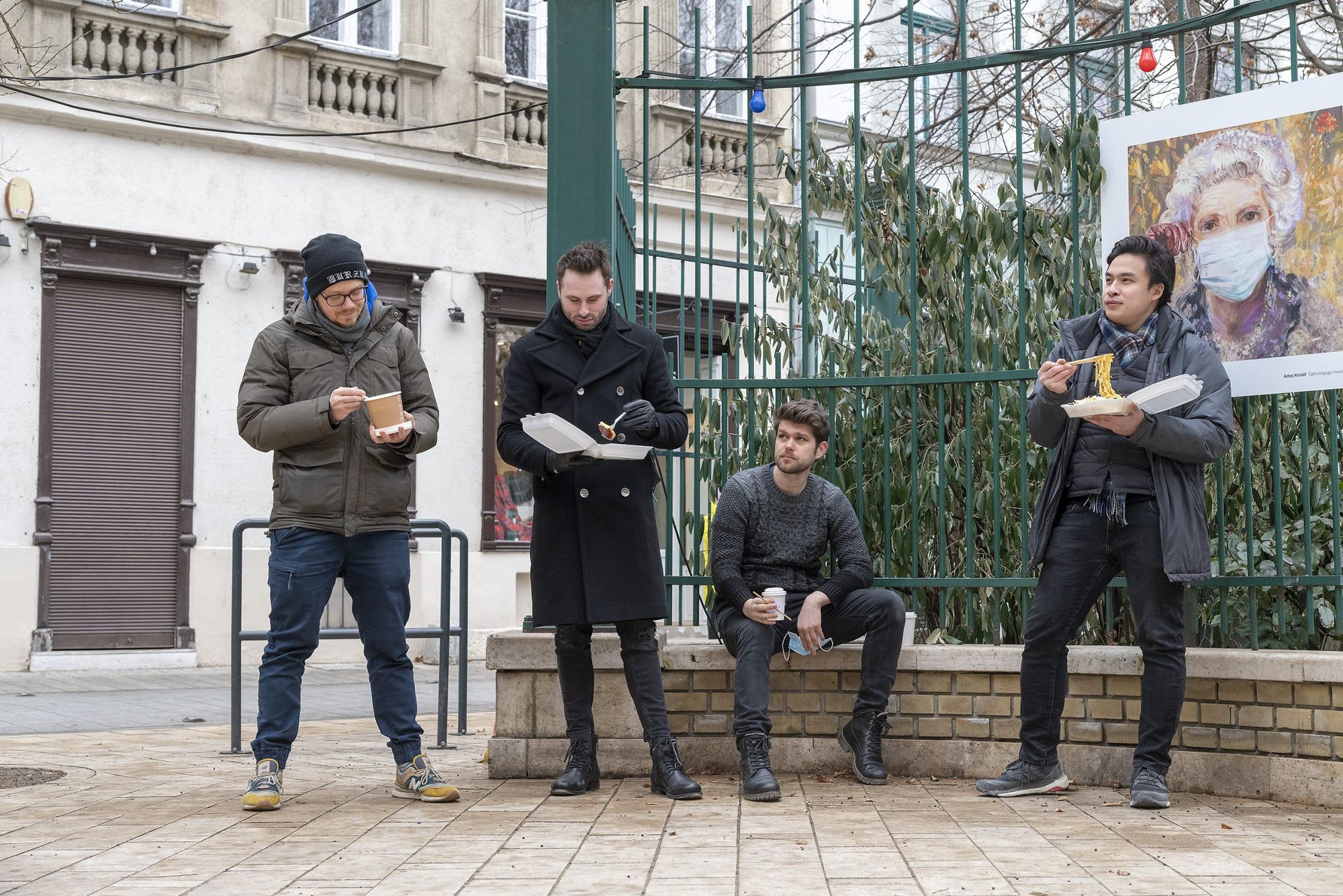
With the restrictions that have been in place for the past three months, probably many of us miss the hospitality sector that usually fills our city with life while also functioning as a melting pot for the various communities, and with it, the cozy cafés, homey Italian restaurants and the atmosphere of faraway cultures. While we are waiting for the reopening, Urbanum’s team joined forces with a group of data scientists to explore the gastronomical network of District V of Budapest on the language of numbers, with the help of a data set recorded at the end of last year.
Authors: Ivett Kovács, information designer; Tamás Gáspár, data visualization engineer; Milán Janosov, network researcher, Datapolis’s lead researcher; András Világevő Jókuti, food blogger and the founders of Urbanum: Vo Son Nam, Balázs Csizik and Géza Kulcsár
Data-based gastronomy
An undertaking of this kind combines three spectrums of knowledge at once: urbanism, gastronomy and data—however, the order of implementation is currently the other way around. Let’s start with data! There are various platforms with different philosophies and functions to collect data starting from completely open platforms organized on a community basis to strictly profit-oriented services. Out of all the options, we chose OpenStreetMap.org, a site built on the power of open thinking and data sharing. From here, we gathered all entities in District V of Budapest categorized as a restaurant at the end of October 2020. As a result of the data processing and visualization process, we were presented with the following—quite telling—map about the cuisines of downtown Budapest:
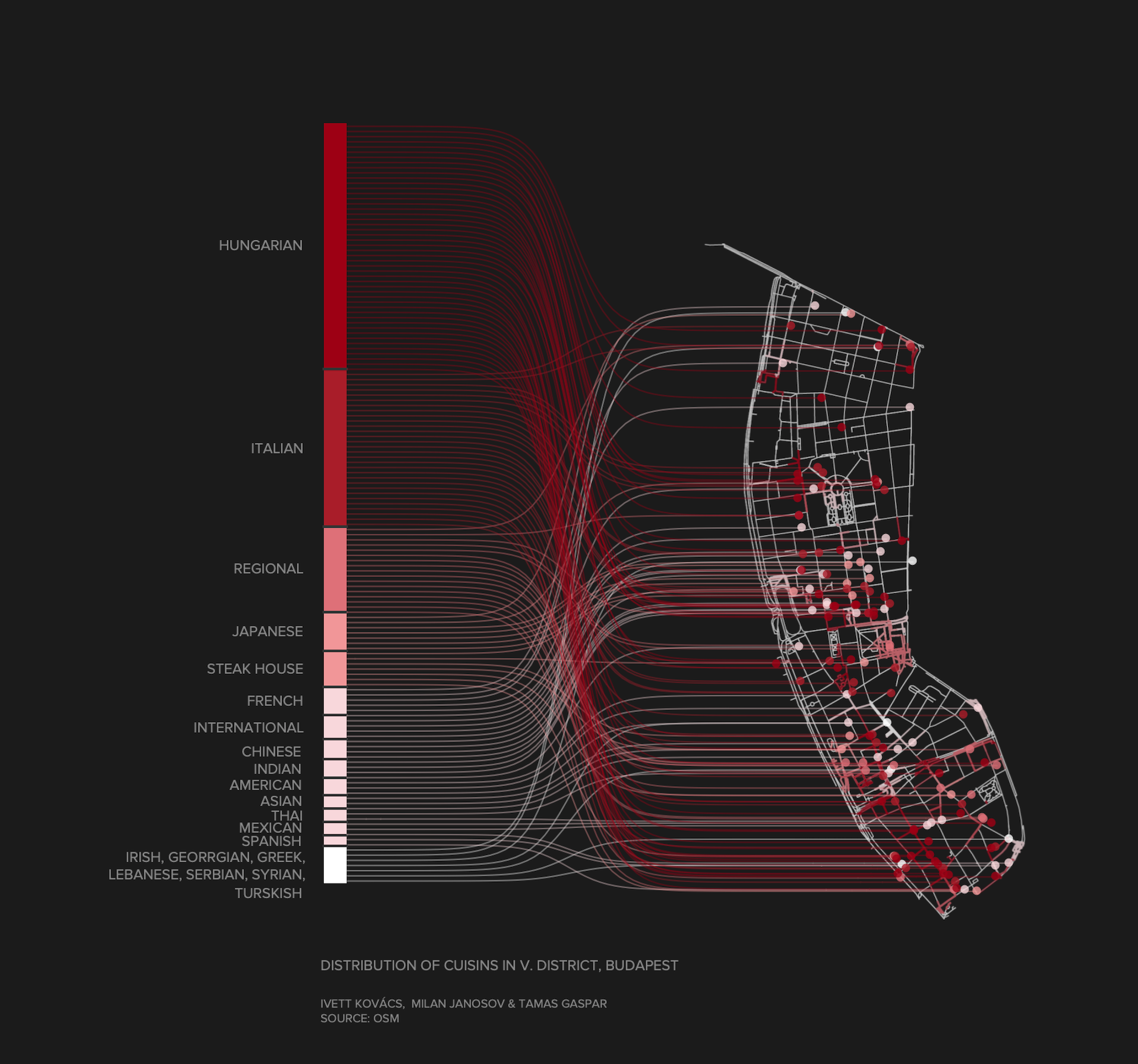
The map contains 492 restaurants and fast food restaurants in total, to more than half of which we could link information related to the entity’s cuisine, after some data cleaning. From this, it becomes clear that Hungarian dishes appear on the menu of 84 restaurants—thus making it the most frequent type of cuisine—, while 56 entities offer Italian flavors to their guests. The total of 43 cuisine types available in the district also include curiosities like Syrian, Irish and Lebanese cuisine.
Identities
However, the data set examined and the map visualization do not only offer a quick insight into the identity spectrum of the gastronomical selection of District V from a bird’s view, but also tell us a lot about business models and the demographic patterns of the audience targeted. In simpler terms: who offers catering services in the heart of Budapest and to whom?
Our research confirms the intuitions related to the area’s cuisine selection: a space primarily motivated by tourism and organized along its needs, like District V of Budapest’s city center, is, quite understandably, dominated by local (that is, Hungarian-style) or other popular regional cuisines that have already become international in some sense (such as Italian cuisine), as also shown by the color-coding of the map. Their repetitive yet evenly distributed arrangement, grouped evidently along the axis of Váci utca, corresponds to what we have expected based on Hotelling’s rule. The rule’s basic theorem is that businesses with an identical or similar category and target audience try to reach the largest possible audience available to them, and to that end, they are placed on the middle axis of the theoretically available market in terms of services, pricing and location in a manner approximating theNash equilibrium. The correlated appearances of the identical tones represent this vividly on the map, especially the dark red shades along Váci utca and the lighter tones near St. Stephen’s Basilica.
And what does a food blogger make out of this?
We also asked food blogger András Világevő Jókuti about the phenomenon, who himself has secured a spot on the gastronomical map of District V through his work by now.
“Those who travel hundreds or even thousands of kilometers to get to know us probably aren’t coming here to taste our pizza, gyros or hamburger, but to experience dishes they can only eat here or dishes they can eat here in the best quality. In terms of our fine dining restaurants, luckily this tendency seems to strengthen, but the simpler genres couldn’t really catch up yet. It is mainly the various types of Hungarian stews, goulash and lángos that can be seen on the menus, and this is quite a poor representation of such a rich cuisine.
It appears to me that market players strive for safety and that it’s more likely that there will be a thousandth hamburger place than a place with a new, truly unique concept.
So what could be a genuinely Hungarian street food that could even be exported abroad while adding a fresh color to the Hungarian selection? Finally I understood that I had to take action if I wanted a novelty and a fresh color, so I developed a new format, which was unprecedented until now: the Hungarian noodle canteen operating with fresh noodles. That was two years ago, and finally just before Christmas of 2020, Nudli Canteen »opened«”, András told us.

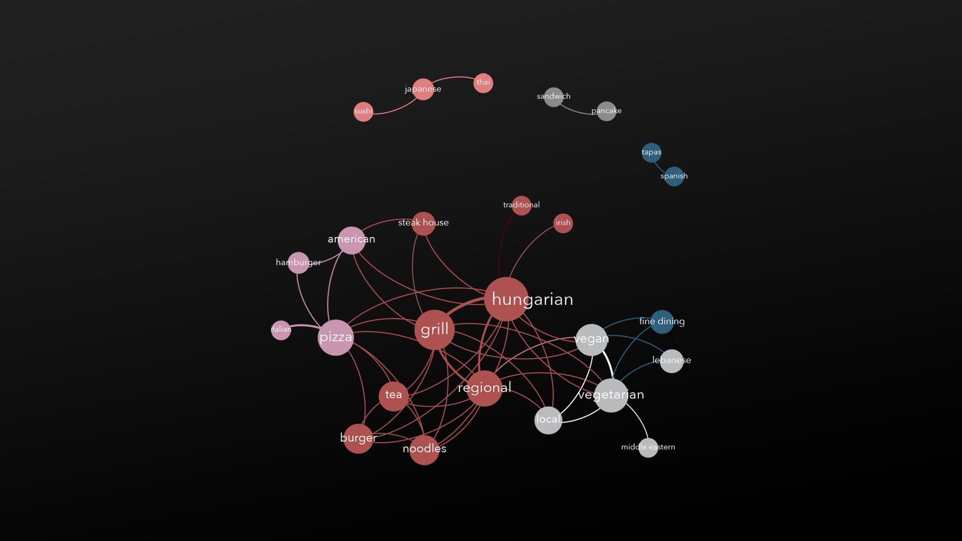
The following network graph also depicts the links between the various cuisines and the market segments targeted by them. The nodes of this visualization are the different keywords linked to the catering establishments, such as Italian, Hungarian or Japanese cuisine. There is a link between two cuisines, that is, two keywords, if there is at least one establishment in the examined data sample that is characterized by both keywords at the same time. The more frequent the combination, such as „regional” – „Hungarian” (the usual stew and goulash…), the stronger the relationship shown by the network. It’s not surprising that Spanish cuisine and tapas, or the various Asian cuisines are closely connected to each other. At the same time, the transition from Hungarian and local cuisines to the vegetarian-vegan kitchen makes us wonder and foreshadows a positive trend—they might offer passage to the world of fine dining, too.
Visualization techniques
And finally a few visualization-technical details for fans.
Similarly to the data on restaurants, the basis of the map we created was provided by OpenStreetMap, or the road network made available by the same to be more accurate, where we displayed restaurants true to coordinates, marked areas corresponding to their 5-minute walking distance with gradation of color, and we color-coded the various types of cuisines.
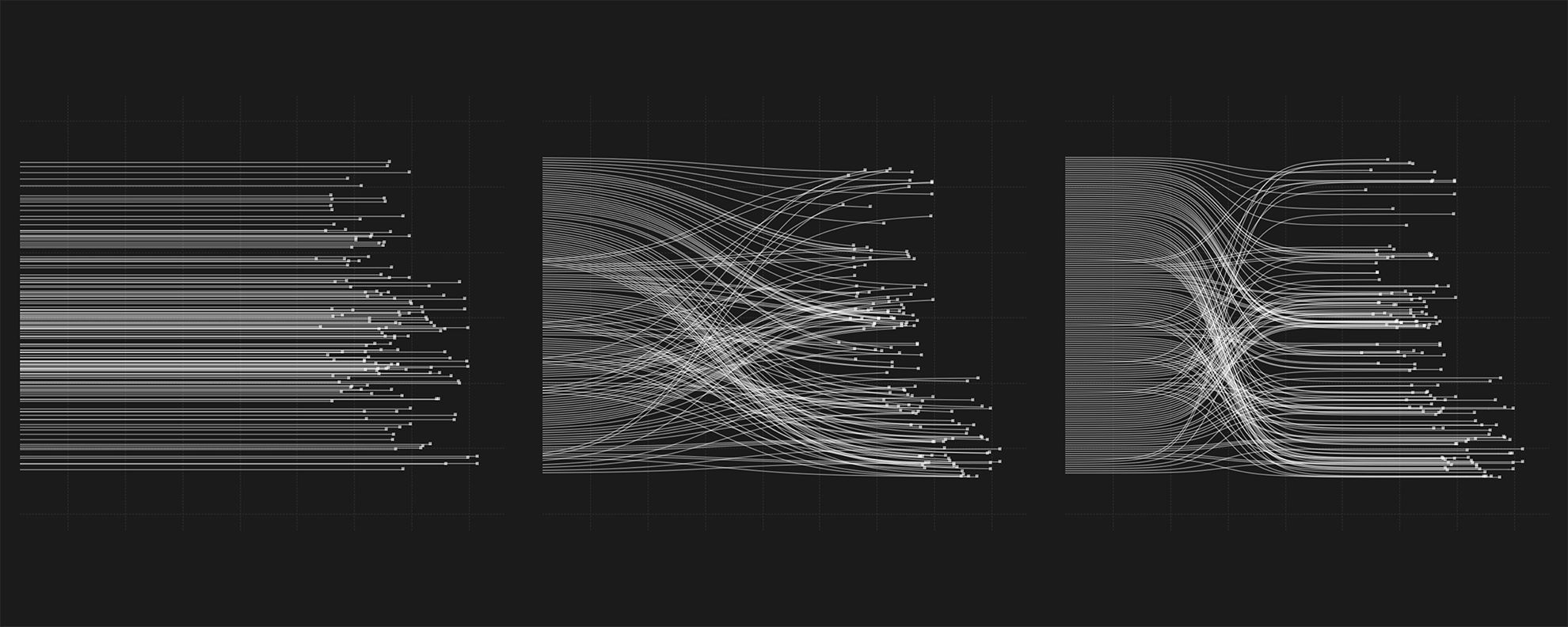
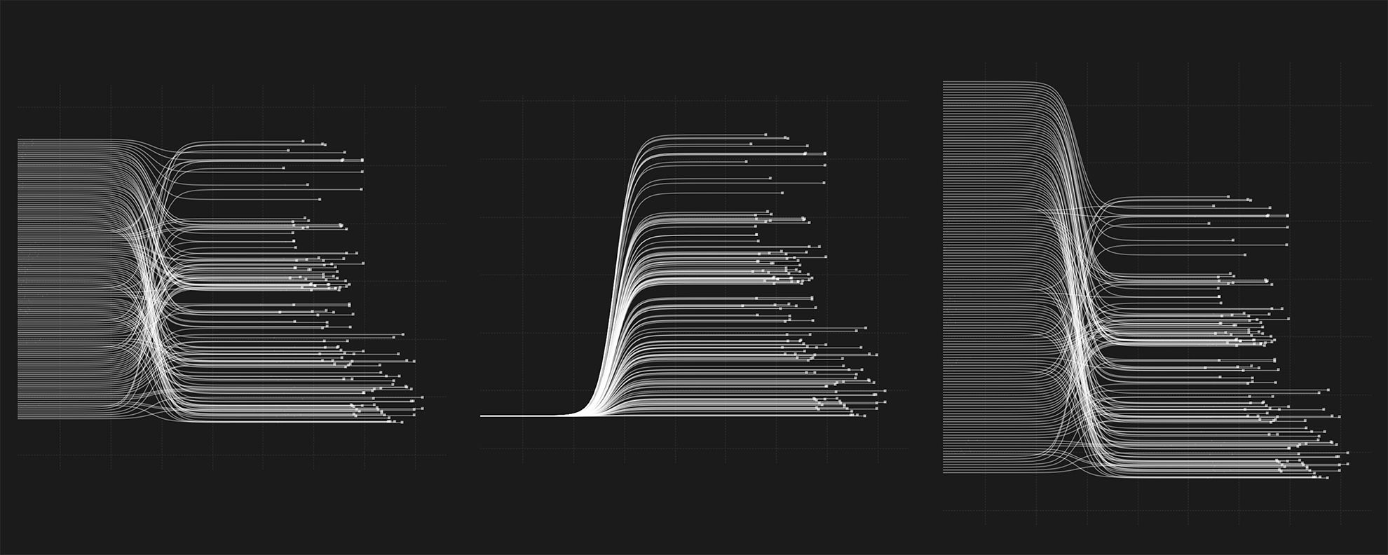
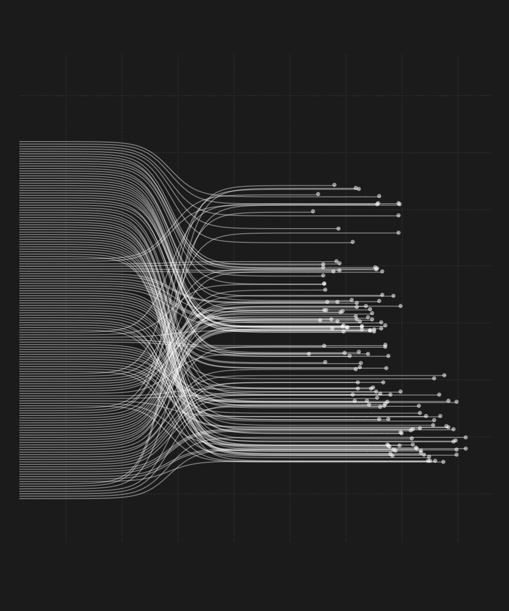
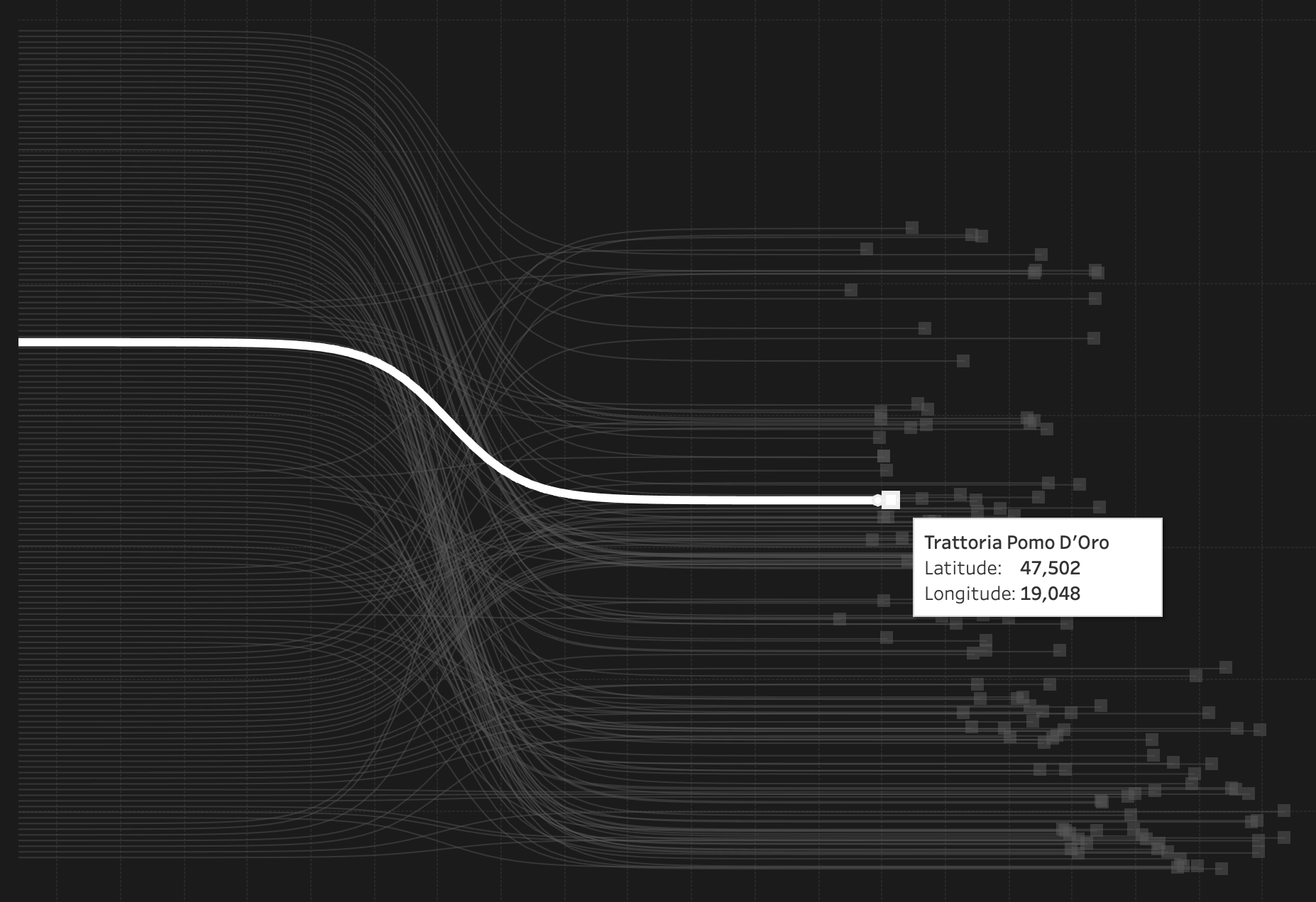
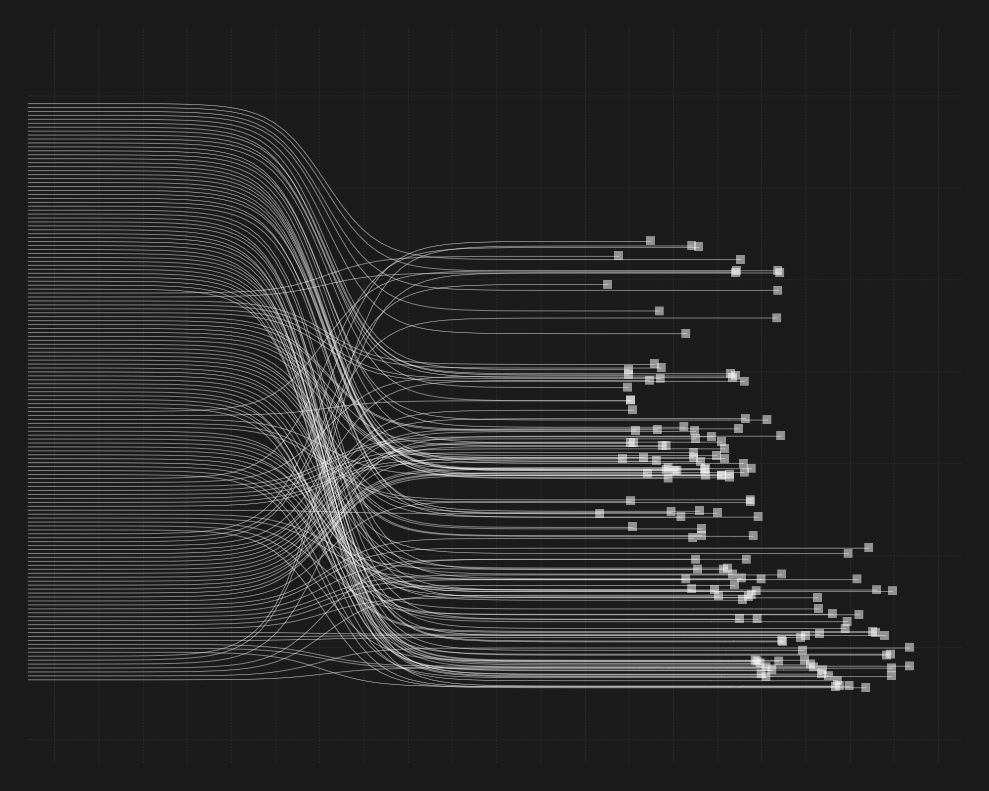
We created the visualization with the help of the Tableau software. Each and every element is based on real geo-coordinates supplied by OSM. We applied a sigmoid function to draw the curved lines. With the distance between the lines and the extent of the curve, we could create diagrams of various ratios and styles, as displayed by the following charts. Our goal was to also include the distribution of restaurant types, thus the calculations were heavily influenced by the division of the left axis, moving from the type occurring in the largest ratio to the smallest. The arrangement within each restaurant type was determined by the latitudinal coordinates of the restaurants within the given type, we placed the ones located in the south to the bottom, and the ones in the north to the top, so that the lines resulted in a well-organized drawing.
All of our works are built on the data of OSM, and, of course, come with all of its advantages and disadvantages. Accordingly, it is possible that certain data points are no longer relevant, or are incomplete compared to the information of other databases or to reality. In spite of this, we have every right to trust the basic authenticity of our analysis, and we are particularly happy that we could take this opportunity to use and contribute to community databases.
Summary
Thus, the first data-driven and community information-based gastronomic map of Budapest’s District V has been made, which is not only informative and spectacular, but, as also highlighted by our article, also carries valuable information in relation to the social and business dynamics of a frequented district dominated by tourism. A big advantage of the developed methodology is that it can be easily put to use in other areas, too, and can be effortlessly expanded by also taking additional factors and aspects into consideration.
Currently, the epidemic overwrites many things we thought we knew about hospitality, tourism and other globalization trends. How will this map look at the reopening (hopefully coming really soon)? How will it look in a year? How will it look in ten years? This analysis laid down the foundations for being able to examine these exciting future processes from a solid starting point.
The next event of Urbanum is also all about urban networks, their data sources and what this all means for us, city dwellers. For more details, check out the Facebook event.
In our article series, the founders of Urbanum as well as the experts participating in the initiative discuss the topics concerning and influencing the city in the form of interviews, case studies and short opinions.
Urbanum | Web | Facebook | Instagram

Songs tied together by visuality | Album covers by Kata Moravszki

Hotel on stilts on the Red Sea | Foster+Partners
